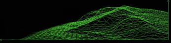
GEO-MODELS
LThe integration
of Geographic Information Systems and 3D real time visualisation tools enables
:
- to use new reprensation models
- to mix realism and symbolism
- to adjust and lower the abstraction
level for complex information
- to ease the comprehension of volumic
data (geology ...) or of complex data (scalar / vectorial fields...)
- to use new analysis tools (3D intervisibility,
3D telemetry, etc ...)
- to add temporality and dynamics (simulations...)
- to access, transparently, to networked
resources (Internet, Intranets, etc ...)
- to communicate
To create new representations ... ?
Illustrations in Galeries
...